


Comprehensive Summarization:
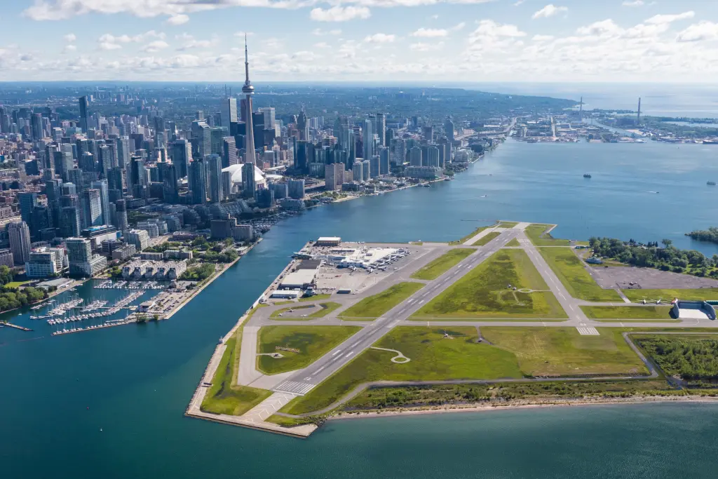
The article introduces the Leica CityMapper-3, an airborne hybrid system developed by Leica Geosystems. This innovative solution merges the latest imaging and LiDAR technologies into a single, configurable platform, aimed at enhancing operational efficiency in urban and regional mapping applications. The system features a Leica MFC250-based camera system powered by Sony’s IMX811 sensor, which offers up to a 30% increase in acquisition efficiency compared to previous models. This camera system supports configurable swath and resolution settings, paired with Hyperion3+ LiDAR scan patterns, allowing for fewer flights and more detailed data acquisition. The multi-configuration architecture of CityMapper-3 enables users to tailor swath width and resolution according to specific flight altitudes and project requirements, while also improving nadir and oblique performance for comprehensive coverage from every angle.
Key Points:
- Leica CityMapper-3 combines advanced imaging and LiDAR technologies in a single, configurable platform.
- The system uses a Leica MFC250-based camera system with Sony’s IMX811 sensor, achieving a 30% increase in acquisition efficiency.
- CityMapper-3 offers customizable swath width and resolution settings to match specific flight altitudes and project needs.
- The system enhances both nadir and oblique performance, ensuring detailed capture from all angles.
- Designed to streamline data acquisition, CityMapper-3 reduces the number of flights required for comprehensive mapping.
Actionable Takeaways:
-
Enhanced Operational Efficiency: The Leica CityMapper-3 significantly boosts operational efficiency by reducing the number of flights needed for detailed mapping. This efficiency gain is crucial for large-scale urban and regional mapping projects, where time and resource constraints are critical. By optimizing flight paths and data acquisition, organizations can allocate resources more effectively, leading to cost savings and faster project completion times.
-
Adaptability to Varied Project Requirements: The configurable swath width and resolution settings of the CityMapper-3 allow for tailored data acquisition based on specific project demands. This adaptability is particularly valuable in diverse mapping scenarios, from high-resolution urban planning to broader regional surveys. By adjusting parameters such as swath width and resolution, users can optimize data quality and coverage, ensuring that the collected data meets the precise requirements of their projects.
-
Integration of Advanced Imaging and LiDAR Technologies: The combination of a high-resolution Sony IMX811 camera with Hyperion3+ LiDAR scan patterns represents a significant technological advancement in airborne mapping. This integration allows for superior data quality, combining the detailed imagery of the camera with the precise LiDAR data. For travel and mapping professionals, this means access to richer, more comprehensive datasets that can support more accurate and detailed mapping solutions, ultimately enhancing the quality of services offered in sectors such as urban planning, environmental monitoring, and infrastructure development.
Contextual Insights:
The introduction of the Leica CityMapper-3 reflects the ongoing trend in the travel and mapping industries towards integrating advanced imaging and LiDAR technologies to improve data acquisition efficiency and accuracy. This development aligns with broader industry trends that emphasize the use of cutting-edge technology to streamline operations and enhance service delivery. As the travel industry continues to evolve, the demand for high-quality, detailed mapping solutions is likely to grow, driven by the need for precise data in areas such as urban development, tourism planning, and environmental conservation. The Leica CityMapper-3 positions itself as a forward-thinking solution that meets these demands, offering a robust platform that can adapt to a wide range of mapping requirements. Furthermore, the system’s focus on reducing the number of flights required for comprehensive data collection underscores a growing industry trend towards sustainability and cost-effectiveness. By minimizing flight requirements, organizations can reduce their environmental footprint while also optimizing operational costs, making advanced mapping technologies more accessible and appealing to a broader range of stakeholders in the travel and related sectors.
Read the Complete Article.